


- Stock: In Stock
- Product code: 00-00012536
Hurry, this offer ends in:


Topographic 3D Scanner XGRIDS L2 Pro with 32-channel LiDAR
The XGRIDS L2 Pro 32/120 Standard Package topographic 3D scanner is an advanced next-generation device. It's designed for high-precision 3D scanning and real-time digital model creation. The device is equipped with a 32-channel LiDAR sensor, visual cameras, IMU modules, and intelligent algorithms.
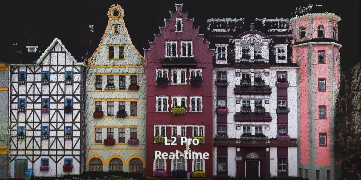
The 3D scanner provides an ultra-dense and high-quality point cloud without the need for post-processing. This makes it an ideal tool for a wide range of professional tasks: from topographic surveying to computer game development.
Key Technical Advantages of XGRIDS L2 Pro 32/120:
Scanning range – up to 120 meters. This allows covering large objects and terrain areas with high detail, maintaining accuracy throughout the distance.
Data acquisition speed - 640,000 pixels per second. High performance ensures fast task execution without loss of quality.
Point interval – 1 mm. This provides an ultra-dense point cloud, suitable for precise measurements and digital model construction.
Relative accuracy – 1 cm, absolute – up to 3 cm. High metrological characteristics make the scanner suitable for tasks requiring engineering precision.
Point cloud thickness – 5 mm. This resolution is especially valuable for mapping complex surfaces and drawing lines.

Real Point Cloud without Delays and Post-processing
True SLAM technology combined with the proprietary LixelUpSample™ algorithm allows for obtaining a photorealistic color point cloud directly at the moment of scanning. This data is comparable in quality to the results of deep post-processing but is available immediately, saving hours or even days in the processing stage.
Reliable 3D Scanner XGRIDS L2 Pro 32/120: Operation in Any Conditions
The scanner uses the patented Multi-SLAM algorithm, which ensures stable navigation and mapping in complex conditions — be it enclosed spaces, underground structures, tunnels, or areas with weak GPS signals. This makes XGRIDS L2 Pro an ideal solution for infrastructure and mining projects.

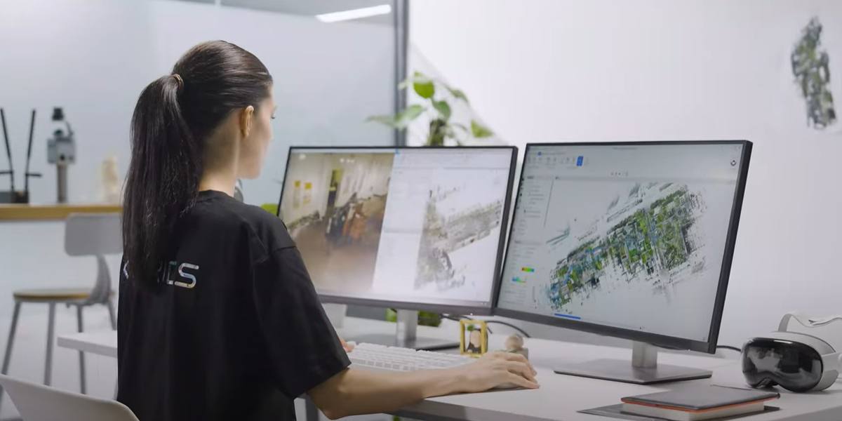
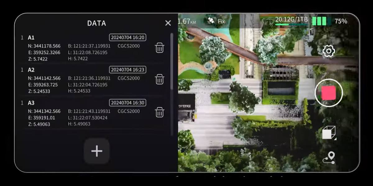
Full Control and Data Processing for Large Area Scanning
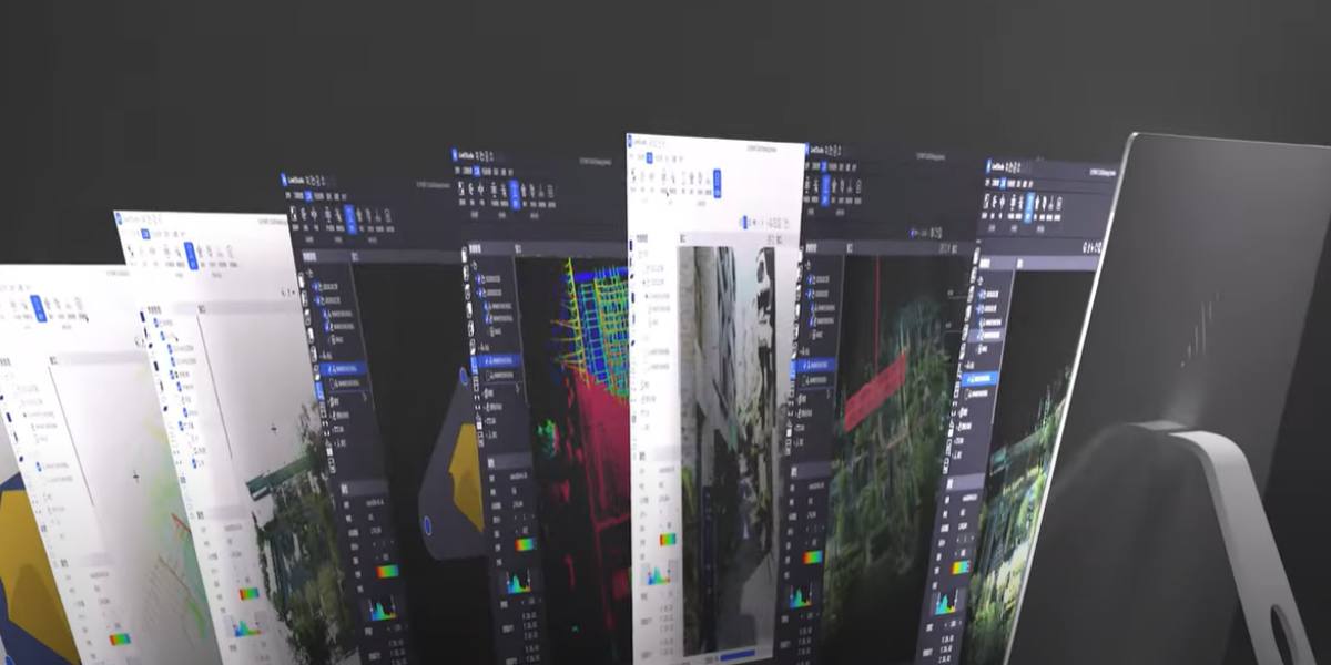
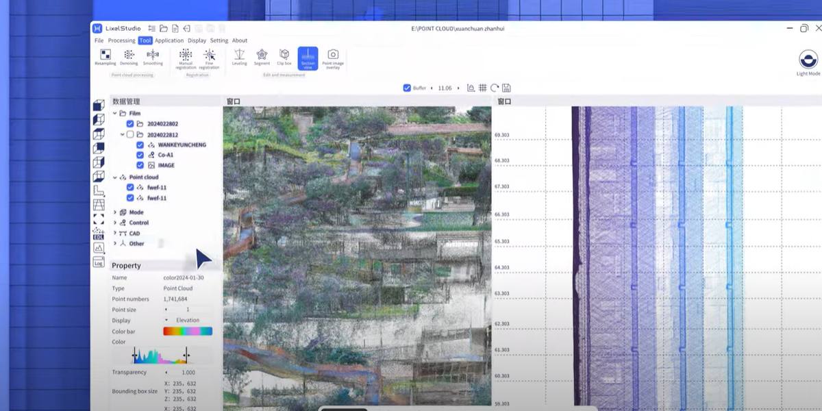
With the LixelGO mobile app, the user gets intuitive control of the scanner: launch, data monitoring, viewing point clouds, camera images, and telemetry all in real time. For full-fledged work with the obtained data, Lixel Studio software is provided, which includes:
Easy Point Cloud Processing
- Tools for panoramic image overlay and map merging.
- Powerful editing functions: noise removal, measurement, 3D cropping.
- Various visualization modes: RGB, height, intensity, etc.
- Automatic and manual accuracy report generation.
- Support for industrial scenarios: volumetric analysis, automatic mesh creation, and more.
XGRIDS L2 Pro 32/120 Standard Package Contents
- Handheld scanner XGRIDS L2 Pro (32 channels, 120 m)
- L2 series rechargeable battery
- L2 charger and converter
- USB Type-C cable
- GCP coordinate collection plate
- Quick user guide
- Warranty card
- Optics cleaning cloth

Durable Protective Case for Transportation
XGRIDS L2 Pro 32/120 is a professional tool that combines mobility, accuracy, and speed of operation. It's optimal for specialists in geodesy, construction, architecture, agro-engineering, technical control, and 3D visualization.

Applications of XGRIDS L2 Pro 32/120 3D Scanner
The versatility and high accuracy of XGRIDS L2 Pro make it an indispensable tool in various fields. Thanks to its ability to quickly and accurately create dense point clouds with absolute coordinates in real time, the scanner easily integrates into the workflows of the following areas:
- Topographic surveying and geodesy. Rapid acquisition of detailed 3D terrain maps with high accuracy without the need for manual post-processing.
- Civil and industrial construction. Used for construction control, monitoring work volumes, digital modeling of objects, and material calculation.
- Architecture and building reconstruction. Allows recording the current state of objects with millimeter accuracy, taking measurements, and preparing project documentation.
- Infrastructure and transport. Ideal for surveying roads, tunnels, bridges, and subways — even in conditions of low light and unstable GPS signal.
- Mining industry and underground works. Multi-SLAM technology ensures confident positioning in mines, underground galleries, and quarries.
- Agriculture and forestry. Used for terrain assessment, biomass, irrigation planning, and modeling agricultural plots.
- Film, game production, and 3D animation. Fast creation of photorealistic 3D models for virtual scenes and game worlds.
- Object inspection and maintenance. Simplifies regular inspection of engineering systems, facades, and structures, allowing detection of deformations and wear.

Regardless of conditions and tasks, XGRIDS L2 Pro ensures high speed, maximum accuracy, and stable results, making it an ideal choice for specialists who value quality, reliability, and mobility. The high technical characteristics of the XGRIDS L2 Pro 3D scanner are, among other things, a result of excellent firmware and software.
Software included in the L2 Pro 32/120 Standard Package
Lixel Studio
This is full-featured software for point cloud processing: viewing, editing, registration, noise removal, length/area measurement, 3D cropping, scan merging (Map Fusion), panoramic overlays.
- Visualization modes supported include RGB, intensity, height, EDL rendering.
- There's automatic generation of accuracy reports and industry tools (volumes, meshes, etc.).
Veesus Suite
A one-year subscription is included free with the scanner (12 months).
- Software from Veesus, VIM, and Gaussian Splats visualization.
- Works locally, without cloud costs: high visualization, Gaussian‑splat rendering, integration with Lixel‑clouds.
Lixel Go (mobile app)
Controls the device from your phone: RTK settings, scan control (pause/resume), camera and color cloud preview, battery/memory/connection monitoring.
Lyxel Cyber Color
Advanced software for advanced point cloud processing and creating VR/AR environments or scenes.
Lyxel Cyber Color features for XGRIDS L2 Pro 32/120:
- Lixel Studio: complete processing, filtering, registration, measurements, reports.
- Veesus Suite: visualization, Gaussian Splats, rendering and point cloud viewing.
- Lixel Go (mobile devices): scanner control, RTK settings, real-time visual feedback.
- Lyxel Cyber Color: creation of VR/AR scenes, scenes and visualization (for some versions).
Our managers will help you choose a 3D scanner without overpaying and adapt it to specific needs using modern functional software. Call us, ask questions in the chat, cooperation with us will be pleasant and productive!


