


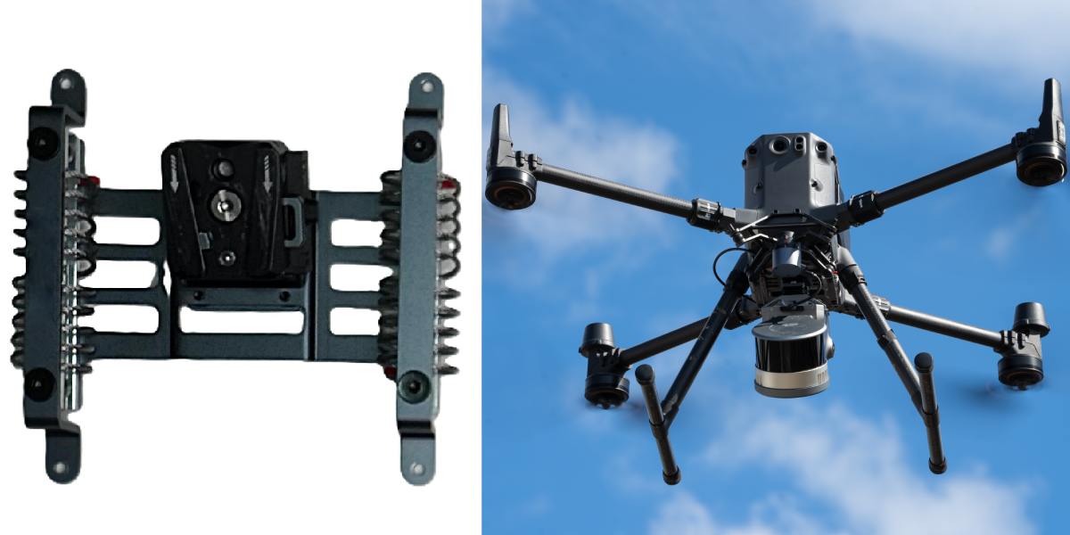
XGRIDS L2 Drone Mount: an innovation in 3D scanning
In the world of 3D scanning, unmanned aerial vehicles (UAVs) have opened a new era of possibilities. The XGRIDS L2 Drone Mount is a specialized bracket designed to integrate XGRIDS Lixel L2 Pro scanners with drones. This accessory allows the LiDAR scanning system to be lifted into the air, providing users with unprecedented access to hard-to-reach and large areas.
With its help, you can obtain high-precision point clouds and volumetric data from a height, which significantly speeds up and simplifies the scanning process. Thanks to this mount, aerial scanning becomes not only more efficient but also safer.
Key features and technical specifications of the XGRIDS L2 Drone Mount
The XGRIDS L2 Drone Mount is designed to meet all the requirements of professional use. It is distinguished by its reliability and well-thought-out design, making it an indispensable tool for working in the field.
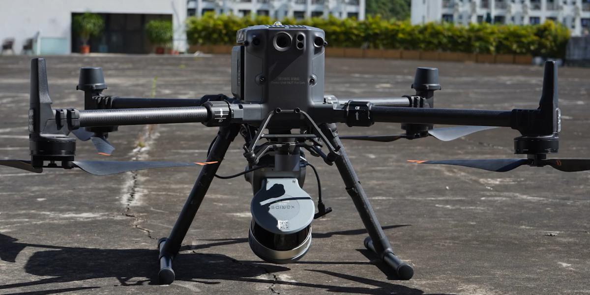
Purpose: To mount the XGRIDS Lixel L2 Pro scanner on drones compatible with DJI Matrice 300 RTK and DJI Matrice 350 RTK models.
Weight: Just 408 g, which provides a minimal load on the UAV, allowing for maximum flight time. The total weight of the system with the L2 Pro scanner is approximately 2.2 kg.
Optimal flight parameters: The recommended height is 30 m (maximum 50 m), and the recommended speed is 3 m/s (maximum 5 m/s). These parameters ensure optimal data quality and density, preventing distortion.
Advantages of aerial scanning with the XGRIDS L2 Drone Mount
Using this mount opens new horizons for 3D scanning, providing a number of significant advantages over traditional methods.
Increased productivity and efficiency
Aerial scanning allows you to cover huge areas (tens of hectares) in one flight, which is 10–20 times faster than ground methods. This is especially relevant for large-scale projects where time is a key resource.
Access to complex and dangerous areas
With the help of a drone, you can safely scan hard-to-reach places: building roofs, mountain slopes, forests, areas after natural disasters. This not only increases personnel safety but also enables 3D scanning of objects that have no physical access.
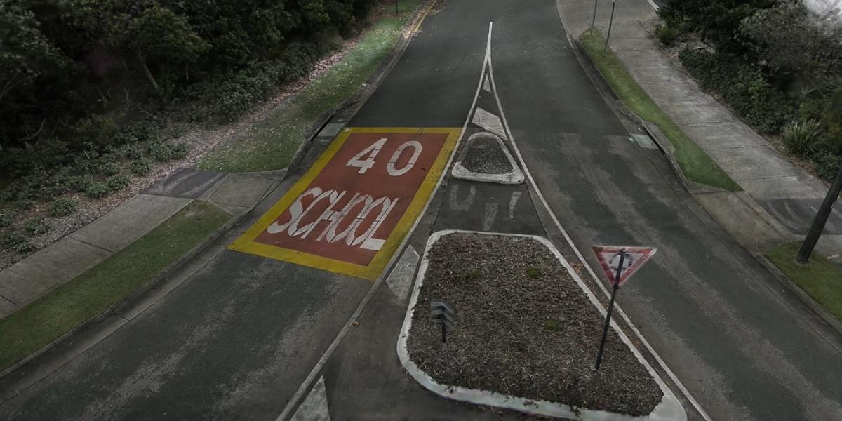
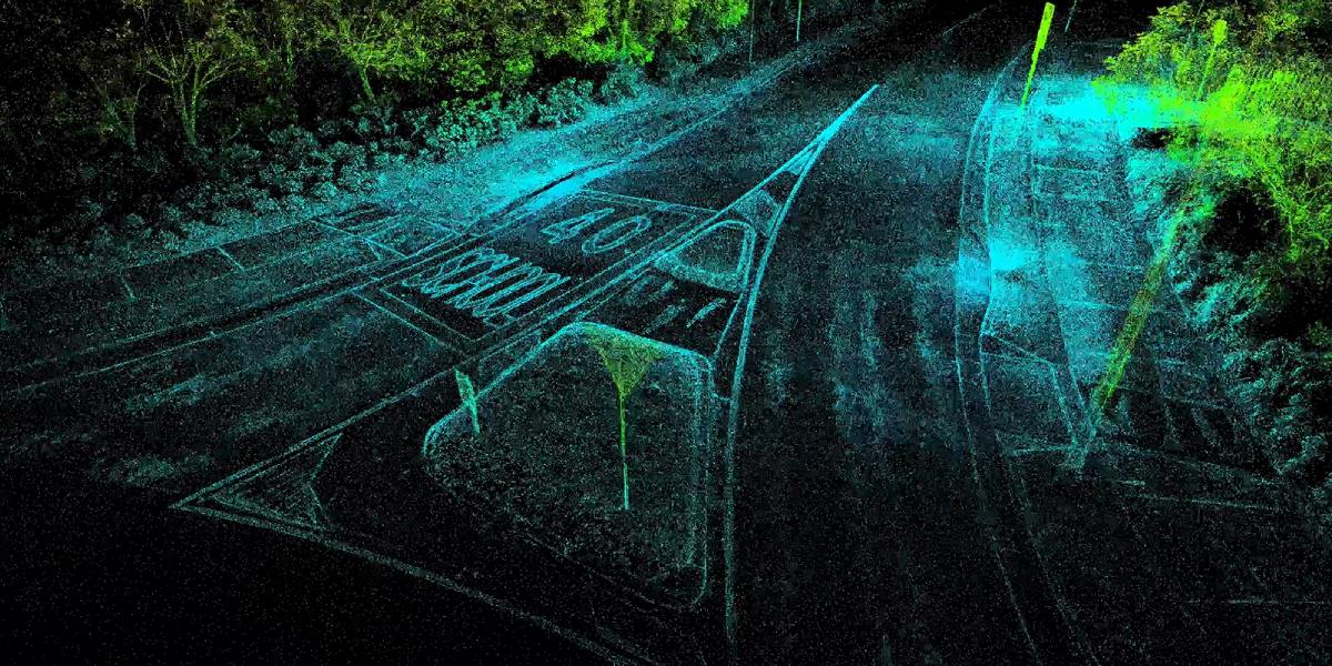
3D scanning from a Drone: improved data quality
Obtaining point clouds from a height allows you to see objects from different angles, reducing shadow zones and reflections. This helps to create more complete and accurate digital models.
Design features that guarantee high accuracy
XGRIDS engineers paid special attention to details to ensure maximum accuracy and reliability of in-flight scanning.
Vibration damping
The mount is equipped with a special vibration-damped design that minimizes the impact of drone vibrations on the scanner. This is critically important because vibrations can cause noise and distortions in the point cloud, reducing data quality.
Rigid and reliable fixation of the 3D scanner on the Drone
The bracket is designed to match the shape of the Lixel L2 Pro body, which provides a rigid and reliable mount with no play. This ensures that the scanner remains stable throughout the flight, in addition to elimination.
Optimization for ease of use
Everything in the mount, from cable routing to fixation points, is made for quick and safe integration. This ensures the convenience of installation and removal, as well as reliable power supply of the scanner from the drone's battery.
Areas of application for the XGRIDS L2 Drone Mount
The XGRIDS L2 Drone Mount is a universal tool that finds application in various fields.
- Topography and cartography: creation of digital terrain models and maps in conditions of complex relief.
- Infrastructure monitoring: inspection of bridges, power lines, roofs, and other high-altitude objects.
- Construction: work control, creation of documentation for complex construction projects.
- Archeology and cultural heritage: careful 3D scanning of objects in hard-to-reach places without physical intervention.
- Agriculture and forestry: vegetation monitoring, erosion control, volume calculation.
- Emergencies: operational 3D scanning of destroyed objects for analysis and planning of rescue operations.
Comparison table of different 3D scanning methods
| Parameter | Drone Mount (with drone) | Ground 3D scanning | Handheld mode |
|---|---|---|---|
| Territory coverage | Very high (tens of hectares) | Medium (limited by the operator) | Low (local zones) |
| Collection speed | High | Medium (requires repositioning) | Low (manual绕过) |
| Detailing | Medium–high (optimal at a height of 30–50 m) | Very high (at close distance) | High (at close distance) |
| Access to zones | Excellent (roofs, ravines, dangerous areas) | Limited (paths are needed) | Limited (physical access) |
| Safety | High (operator at a safe distance) | Medium (working in the field) | Low (operator close to the object) |
The XGRIDS L2 Drone Mount is not just a bracket but a key to a new level of efficiency and safety in 3D scanning. It opens up possibilities that were unavailable when using traditional methods. If your project requires 3D scanning of large areas or you are working in conditions of limited access, the investment in this solution will pay off many times over, saving time, resources, and ensuring the highest quality of data.
Call us: we always have a wide range of 3D accessories in stock that increase the accuracy and speed of work, saving time and money.


